


Massport Annual Report 1965 here
Massport Annual Report 1969 here
Wood Island Park

Airport maps


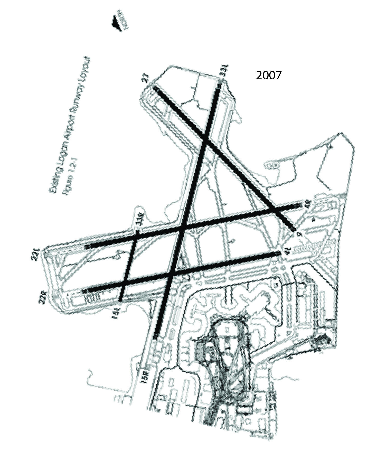

Runway headings
I have been curious about something for a long time. Olympia has been working on a runway extension project at Logan, and I have noticed that Runways 4/22 points 20.04 degrees west of North, so it should properly be 2/20 (see below). Similarly, 15/33 points 45 degrees east of North or 314.95, so it should be 13/31. Today I realized that compass declination could explain this.
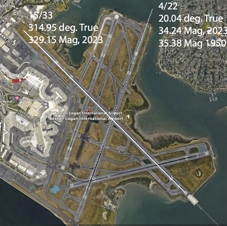
The compass declination at Boston is 14o12’=14.2 o to give 34.24 for 4/22 and 329.15 for 15/33. So, Google Earth gives true north, and the runway heading is magnetic North. I checked and found this slide deck that explains things nicely.
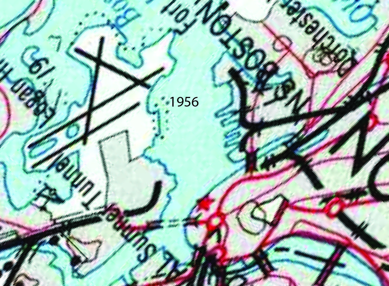
However, for 4/22, 34.24 should round to 3, not 4, and I do not think MassPort is that sloppy. However, the magnetic declination changes by about 0.1 o per decade, and the headings were designated around 1950, when the declination was 15.33, giving a heading of 35.38, which rounds to 40, so all is good. MassPort built the first segment of 15/33 before 1956, when the heading was 330.29
East Boston Neighborhoods